
Forest management
Monitor large timber estates with sensors at high risk areas. Early alerts help prioritise response before fires run beyond control.
Pick the one you need
Our service & product
95%
Detection accuracy
7 days
Advance risk forecast
24/7
Continuous monitoring
One continuous flow from field sensors to actionable intelligence
Ground sensors capture temperature, humidity and pressure in real time
Long range networks relay encrypted data from remote locations
Cloud based models support fire risk using historical and terrain data
Receive alerts with location, risk level and recommended actions
Stop juggling disconnected tools. Get one integrated system that works.
Everything your team needs to monitor, forecast, and respond — from sensor data to satellite imagery.
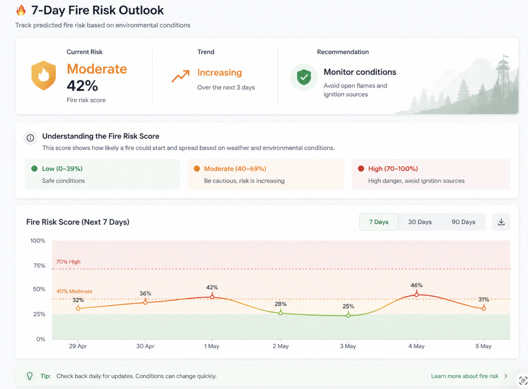
Track predicted fire risk based on live environmental conditions. See the current score, trend direction, and a plain-language recommendation — updated continuously.
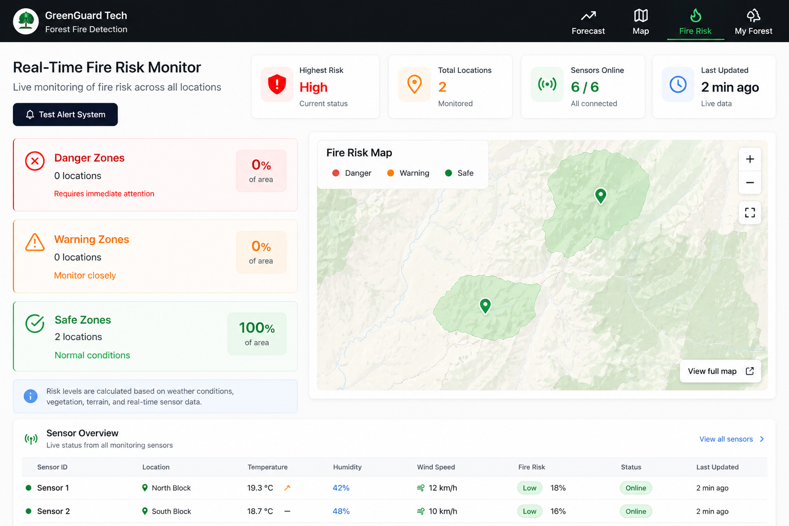
All your monitored locations plotted on an interactive map. Click any sensor pin to see live temperature, humidity, and risk readings from that node.
Your estate is divided into Danger, Warning, and Safe zones — calculated from sensor readings, weather forecasts, terrain, and vegetation data.
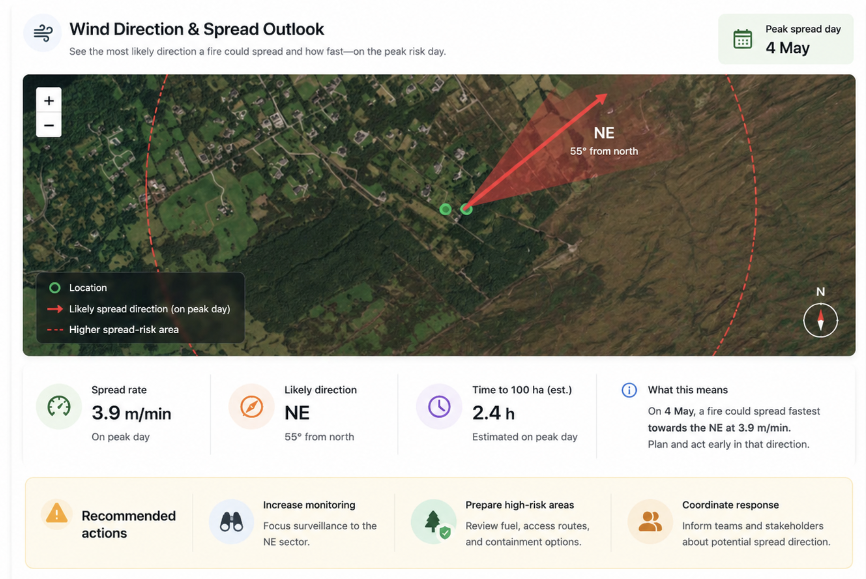
Switch between Sentinel-2 and Landsat satellite layers including NDVI vegetation index — to understand the health and structure of your land from above.

Where WIaaS supports different environments and operations
Monitor large timber estates with sensors at high risk areas. Early alerts help prioritise response before fires run beyond control.
Line and substation adjacent land in fire prone areas. Real time risk supports crew planning and public safety when conditions tighten.
Protect land, outbuildings and water points. Coordinated alerts fit alongside seasonal field work, not as a one size fits all map layer.
Get early wildfire detection with our integrated intelligence platform. Contact us to learn how WIaaS can support your land.
Contact us